Last Sunday (July 31) I had a very hard landing while flying the NCSA Grob 103 (N3981C) at KTRK. Several members of the club have asked me what happened, and since I think my experience can help others avoid a similar situation, here is a description of what happened.
First, let's be clear: cause of the event was pilot error. I'd love to say otherwise, but I cannot. I blew it.
The short version is that, despite being aware of the hazards and the weather conditions, and actively thinking about them throughout setting up the landing and the downwind leg, somewhere between turning base and landing I managed to let the airspeed bleed off so that my final approach was made without sufficient airspeed margin. The more detailed description is as follows:
The landing took place on runway 20 at approximately 2:20 pm, at the end of a flight of approximately 38 minutes duration. I was flying from the back seat; I had a passenger on her first flight in a small aircraft in the front seat.
The general conditions of the day were that the valley was filled with smoke from nearby fires, there was a southwesterly wind varying from 10 to 20 knots on the ground, and the air was somewhat turbulent aloft. The smoke affected the visibility, so that nearby mountains were visible in outline, but not detail, and from 10,000 feet directly over the airport the town of Truckee was easily located but hard to make out in detail; locally, however, (within several miles) visibility was fine and was no factor.
My passenger became somewhat nauseous as we climbed through 10,000 feet in bumpy thermals, and asked me to fly straight instead of turning; I accommodated her wish, flying a long back-and-forth pattern through the house thermal over the frog pond, losing a bit of altitude on each pass until I was down to 8300 feet or so, and informed her we would have to thermal or land. She asked me to land, so I headed back to the initial point.
The area around the North Star parking lot was solid lift, and I had to use full spoilers to drop to pattern altitude for entry on the 45. I closed the spoilers before I entered the pattern; realizing I wanted to preserve my altitude. While maneuvering toward the pattern entry I tuned in AWOS. Wind conditions were reported as “240 at 10 knots, gusting 21 knots”. The wind was at 40 degrees to the runway heading, and I realized this meant the crosswind and parallel components would be similar in strength and would likely be somewhat less than 10 knots. In a gust, though, the crosswind component could be noticeably higher, even as much as 16 kts or so.
I consciously applied the adage of adding “1/2 the wind speed” to the book approach speed of 55 knots. I split the difference between wind and wind+gust and decided to add 7 knots to the approach speed, making my approach speed 62 knots. I also reminded myself to make a high approach and turn downwind-to-base “inside the spillway” (Martis Lake Reservoir has a spillway northeast of the approach end of runway 20; the plan was to make the turn between the end of the runway and the spillway.)
There was no traffic in the pattern; a tow plane and glider departed from runway 20 as I entered the downwind leg and was no factor, and a general aviation aircraft was at the threshold of runway 29; they radioed to me that they would hold their takeoff roll until I either crossed runway 29 or rolled to a stop on runway 20; again, they were no factor.
I made several radio calls: that I was about to enter the pattern, upon entering the 45, upon turning downwind, upon turning base, and upon turning final. It was just after I called the turn to base that the general aviation aircraft holding on 29 called me and we had our brief conversation.
I made my turn to base leg inside the spillway, as planned**. I opened my spoilers on the base leg, but as I turned final I felt I was getting low too fast and closed them. I felt my speed was ok*, but I do not recall actually checking it at that time.
Then things got dramatic. As I crossed the cliff at the end of runway 20 I encountered either a sudden lull in the wind or a rotor over the cliff’s edge; whichever it was, the practical effect was sudden loss of airspeed and, without sufficient airspeed margin, a loss of lift. The aircraft dropped “like a stone.” It was a sickening feeling to sense it dropping so fast and realizing I had essentially no control over what it would do.
But I knew what was obviously what was going to happen- a hard landing was in my very near future!
We landed very hard on the main wheel, at or just barely beyond chevrons marking the displaced threshold. I rolled to a stop on the apron where the tow planes normally park. The landing was hard, but I did not feel the tail wheel hit, and I do not think it did. Nor do I think the nose wheel hit; it felt like I came down squarely on the main wheel. I do remember being a bit surprised that we did not bounce back into the air noticeably.
So how did this happen? I believe the cause of the hard landing is that I allowed my airspeed to bleed off during the base leg and the turn to final, and hence did not have sufficient margin on the airspeed to compensate for any gusts, lulls, or wind shear that I might encounter (and that, obviously, I did encounter). This was exacerbated because, despite my best intentions, I did not come in on a high, steep approach. I allowed myself to come in too slowly, and lower than I had planned.
As I said when I started: pilot error.
=======
I wrote all the words above Monday, while the incident was still fresh in my mind. Tuesday morning I carefully examined my IGC file using OLC, skylines.aero, and Doarama, and discovered, to my surprise, that:
* 1) I was flying even more slowly than I had recalled on my final approach. The GPS ground speed on my downwind leg was 70kts, on base leg 62 kts, and on the final approach 45 knots. If I assume 10 kts of wind at 240 degrees the airspeed values become more like 63 kts on downwind (essentially as I had planned) but only 52 knots through most of the final leg. I also saw that I allowed the speed to further bleed off to 38 kts (GPS ground speed) just at the threshold. If the wind were still at 10 kts that would have been 45 kts of air speed, barely above stall speed, as I crossed the threshold about 50 feet above the ground. If I hit a lull (or the wind was blocked by the trees, which is what I think actually happened) I would have been at or below stall speed! That is what I believe occurred; I stalled the aircraft while still well above the ground, and down we went. I still had forward momentum, of course, so still rolled out along the runway after the landing.
**2) moreover, although I started my turn to base "inside the spillway," I did not crab and I let the wind blow me into a rounded base leg rather than a square one, drifting downwind so the base leg was actually outside, rather than inside the spillway, making my final leg somewhat longer than I planned.
3) The analysis confirmed something I had realized just after the incident, namely that I should have flown the entire pattern higher, and that I had lost sufficient altitude on the downwind leg that I should have made my base turn considerably earlier, probably when I was even with the numbers. I had actually made two turns between NorthStar and the Initial Point (the so-called Lone Pine) specifically to burn off altitude with the goal of entering the pattern around 7400 feet, 1500 feet above ground. But I made the turns too far out from the IP and was in sink from where I made the turns all the way to the IP, so that when I reached the turn to downwind I was already down to 6800 feet, just 900 above terrain! I did observe during the downwind leg that I was lower than I wanted to be; however, for some reason, I did not correct for it appropriately with an earlier turn to base.
In short, I was too low and too slow and I did not recognize and correct for those facts.
= = =
So, what is my corrective plan for the future?
First, whenever I fly in future I will strive to be more attentive to my landing plan, making sure I am following it and also making sure that it is working; I’ll be much quicker to make an adjustment, such as making the base turn sooner.
That's in general. A more specific corrective plan involves what I will change about flying at Truckee. I talked with Mike Mayo shortly after the incident – when I told him my airspeed plan had been 62 kts (approach plus half the wind), he observed that the "approach speed" in the POH was selected with nice, smooth-air, open field German landing strips primarily in mind, and not for the kind of roiling conditions commonly found in Truckee (and other gliderports in the Western USA) and that his approach at Truckee is to always come in at least at 70 kts, if not 80 kts, precisely because of the rotor and tree-line effect on runway 20. As he pointed out, runway 20 is a long runway, and coming in with plenty of airspeed at worst means the ground crew has to drive the golf cart a long way to get you. His comments make sense to me, so I will elevate my basic approach speed for KTRK from 55 to 65 in a G103 and then add for the wind speed from there. This would have made my target speed for this landing 72 kts. I will also follow my plan of entering the pattern at a higher altitude than I did. In conversation with Larry this afternoon, he observed that he likes to hit the Lone Pine IP at least 1500 feet AGL; in fact, that had been my plan, but I actually was 600 feet lower than that when arrived at the IP. I think, with the long runway to use, a higher, steeper, faster approach has now become my normal plan for Truckee, with modifications for specific conditions as necessary.
====
Finally, there is a very frustrating side note to all this. I was well aware of Bill Gawthrop’s crash at Truckee two years ago. Like many pilots, I have studied his trace and I have read with interest not only his description of the event but also the lengthy discussions and analyses of his accident on rec.aviation.soaring. I was very much aware of the mistakes Bill made, and I actually thought about them as I was setting up for the landing pattern.
And yet, I still came very, very close to replicating his experience.
Having a plan is only useful if you follow it while it is working, recognize when it isn't, and take decisive remedial action when necessary.
V/R,
Van Henson
You can see the trace of the flight at Skylines.aero, at:
https://skylines.aero/flights/66931/
I've also put together a Doarama visualization of the last few minutes of the flight only, which may be seen at:
http://doarama.com/view/872321
I also posted it on OLC, so another trace can be seen at:
http://www.onlinecontest.org/olc-2.0/gliding/flightinfo.html?flightId=1234794473
Friday, August 5, 2016
Wednesday, August 3, 2016
Dan Colton goes to White Castle (well, flies the Whites, anyway!)
On July 16th, 2016 I had the distinct pleasure of
sharing a 503 km cross country flight with Tim Gardner as my XC mentor. The flight was a raffle prize generously
donated by Laurie Harden of Soaring NV at the Pacific Soaring Council awards
banquet last winter.
Thank you Laurie
and Tim!
 |
| The Soaring NV flight line |
My soaring cross country experience started last summer and
since then I have logged a little over a dozen flights in the 200-300 km range
and I was thrilled when they pulled my name out of the hat for this cross
country mentoring flight up at Minden in a Duo Discus.
I scheduled the flight and watched the weather with great
anticipation as our date approached. It
is a 4 hour drive to the Minden airport from my house in San Carlos, CA. But this was well worth the effort given the
huge learning opportunity I was looking at.
I arrived at KMEV at 10am and met the staff at Soaring NV. They were polite and professional and I felt
right at home.
Tim showed up shortly
thereafter and we discussed the weather, TFRs (what would flying the Sierra be
without at least 1 forest fire TFR), airport procedures, and chose our route of
flight and outer turn-point. Based on
the forecast we opted to fly South to the Whites and get to at least Bishop
before turning back and we agreed that 4pm would be the latest we should turn
back in order to make it home before the lift shut down.
 |
| Inside Soaring NV |
Lucas was working the line and helped up get the glider
ready and out to the line. We were
number two for tow and were in the air at noon.
We took a 3,000’ tow because it was completely blue, the local lift
wasn’t very good for getting out of the valley the day before and the forecast
for today was about the same. Our first
climb got us 13,500’ and the optimism to run down the Pine Nuts and try for the
altitude needed for the jump to the next range.
But we got stuck at the end of Pine Nuts waiting for the lift to get
organized.
After thrashing around for over a half hour working week/disorganized
lift we made it to just over 14,000’ near Farias Wheel Airport and headed South
to the Pine Grove mountains where some clouds were starting to form. A couple thermals later we were over 17,000’
and charging on past Baron Hilton’s Ranch and Lucky Boy Pass (I took this as a
good sign). All along the way Tim was
pointing out airports, waypoints, decision points and xc strategy. I was impressed and grateful for his wealth
of knowledge and teaching style.
 |
| Southbound into the blue |
 |
| Soaking up the adventure with an excellent teacher |
Now we were cooking
and making good time. We worked a couple
thermals along the way and were able to stay above 15,000 and with over 17,000’
had a comfortable altitude cushion for the 35 km jump to our next goal,
Boundary Peak and the White Mountain range.
The flight thus far was an incredible experience and I was a sponge
absorbing all the information along the way.
My prior cross country flights were in the area to the North and West of
Minden between Truckee, Air Sailing and Nervino and this was this was my first
time flying out of Minden and to the South.
As we approached the Whites I was awe struck. Tim said that soaring the Whites is a great
experience, but all that much better when you have to fly a hundred miles to
get there.
 |
| Heading back to White Mountain |
We started off ridge
running all the way to White Mountain where Tim showed me how to thermal a
canyon from below ridge top. I let Tim
take the controls for this lift and was impressed with his skill and a bit
nervous every time we turned into the ridge as this is a skill I had not yet
developed. We were climbing like the
proverbial bat out of Hell when Tim asked if I could see any hikers on the
ridge-top path. There were about a dozen
and Tim decided it he wanted to give them a photo opportunity. So it was time for full spoilers and we
spiraled down a couple thousand feet back down to the ridge were he gave them a
high speed pass “up close and personal”. Here is a link to a video of the fly by:
 |
| "This is Maverick, requesting permission to buzz the tower..." |
Now it was back to my turn to get that altitude back and off
we went South across the valley, over Bishop and beyond to just pass Coyote
Flats. We got there low, at around
11,000’, and it was a struggle getting back up.
Another glider was reporting a strong convergence over the Sierra to the
South and West of our position and asked if we wanted him to wait so we could
join him. We could see the cloud streets
from where we were. However, it was
going to take us too much time to climb out so we told him to keep going as we again
struggled, waiting for the thermals to cycle.
Our persistence paid off but it was now around 3:30 pm and close
to our agreed upon turn-back time. Since
the clouds to the North were starting to dissipate we agreed to head back and
had to make our next decision. Do we
cross the valley back over to the Whites where the lift was still strong and
marked by a cloud street all the way back to Boundary peak or head off on the
more direct path toward Mono Lake.
 |
| Cu markers ahead |
Although we saw only two cloud markers we decided to go
direct to Mono Lake. It was 35 km to our
next good climb and then we crossed a big blue patch with no lift for about another
55 km. This lift was a bit disorganized
but we again persisted and got the altitude we needed for the next jump to Mono
Lake.
 |
| Looking at the Sierra from the east |
We chose well and reached just South/East of Mono Lake at
14,000’, found a climb to 17,000’, and were off on our next jump North.
 |
|
Running the gauntlet direct to Mono Lake, Sierra to the
left and Whites to the right
|
 |
| Time to go, Sierra on your hip, go fast! |
Our next struggle was above the old ghost town of Bodi in
weak/disorganized lift with only 1 knot on the averager. Our second thermal in that area was much
better and at about 15,000’ we encountered wave and were blessed with smooth
6-8 knots lift to 17,999 and had final glide in the bag. Our glide back was a straight shot of 95 km
at 120-130 knots ground speed and was very satisfying after such a challenging
day.
By the numbers we did 503 km, soared for 5.5 hours at an
average ground speed of 90 km/hr, and used 41 thermals to get around the task. It was an amazing experience and I would
recommend it to anyone wanting to kick-start their cross country soaring
training.
Here is the trace of the flight, which can be found in more detail at https://skylines.aero/flights/66975/


And lastly, I cannot end this tale of good fortune without
again praising the staff, tow pilots, instructors and line kids and fleet of
SoaringNV. This type of one-on-one
training cannot be passed up.
So give a big Hello to Laurie and the rest of the crew from
me next time you are out at SoaringNV and take them up on their offer, whatever
it may be. You will be glad you did.
Sincerely,
Dan Colton
Saturday, June 18, 2016
Todd's 2016 Glider Palooza Report
Dan Colton generously offered to take NCSA students and new pilots along in the club two-seat Grob 103 “KP” during the “Panoche Glider Palooza” Memorial Day weekend gathering, which presented opportunities for flying cross country, located in Panoche, CA. After chatting with Dan at Byron about it, I jumped on board!
First, the drive. I elected to take a “direct” route, 101 to Gilroy, Hollister, CA-25 to Panoche Road, which narrowed down, and later on one could easily fly off a cliff in the car if not paying attention, as it was so winding and narrow and bumpy. There’s no cell service. I would not recommend it at night. (The route through I-5 from the north is better.) There seems to be a transportation jinx for new club members, as last year Star got stranded and had to wait a couple hours by the road for a car to even come along, someone told me, and this year Ace got locked out of his rental car with no possible service. I was glad to arrive safely after the cross country drive. Still on the ground and already it was an adventure.
The “Panoche International” airstrip setting is in a dry, beautiful and uncanny flat valley surrounded by mountain ridges. And in the middle of truly nowhere, a stark setting, almost cinematic. Before flying, it already looked to me like a glider pilot’s dream to be there with other pilots. Everyone camped at Mercy Hot Springs which is about 8 miles north.
In the morning I had a quick chat with Ramy and Dan at Mercy Hot Springs, Ramy asked if I was ready for my first cross country experience. Yes! We talked briefly about what it means to fly cross country, what the risks and mental approaches are. Ramy said he defined it with three points: to fly beyond glide of your home base, to fly beyond sight of your safe glide airport, and to be able to move comfortably between safe glide airports without stress which you learn by experience and good planning.
After a brief drive to the airstrip, everyone was prepping and eager to fly. There was a lot of scanning the horizon for the first sign of cumulus or the sound of an arriving towplane. Buzz was the first to launch, and radioed down he had 8 knot lift just above us, making everyone jealous and antsy and excited while waiting. There were still no clouds and no tow plane. Ramy was lined up next. Eventually the towplane appeared and immediately one launch after another with quick, low releases into lift.
Dan and I launched near the back of the pack of gliders, after noon, into a cloudless sky. Despite worrying about the dust, I accidentally left my side vent open during take off and as we flew into the dust cloud behind the tow plane I got a couple nose fulls before quickly closing it! Once in clean air we immediately opened our vents. We released at 5100' MSL (3800' AGL) on the West Ridge and caught our first thermal in the blue and rode it to about 8,000 feet. We then proceeded to the convergence line marked on the West side of the Idria Valley by intermittent clouds. (At this point, I didn’t know it was the convergence, we were just looking for lift and a route south.) From there we followed cumulus clouds and picked our way down the Benito Range, over many remote open-pit mountain mining sites which at times looked like snow, to Wright Mountain.
We flew cautiously with some back and forth yo-yoing up and down the Benitos and meandering, still keeping Panoche within safe club glide (18:1) and unsure what else to do. Early on Marianne had warned us that conditions were weak and uncertain beyond the first mountain ridge and the clouds did not have reliable lift under them, so we were in doubt how good the lift could be, especially further south. We finally cruised to the southern-most end of the Benitos at the Microwave towers. It looked promising, so we tried to set out across the gap over a valley to Center Peak and almost made it but stopped just short because we were hearing other pilots ahead of us reporting to be struggling. We headed back up the Benitos to EL5 (elevator 5 waypoint, as mapped by Ramy) and did some more yo-yoing.
Just then Eric Rupp in his ASW-27 “ER” offered over the radio to team fly with us down to Black Mountain and said the convergence was well established further on, filling in and now nicely streeting along the way. It was just the excuse we needed. (I’d like to think his kind offer was because I bought him a drink the night before, but he probably already forgot. Though it was non-alcoholic!) We flew north and Eric flew south to rendezvous at EL5 and we turned south together and were off.
We thermaled a few times but it was a good day as Eric put it, “to practice not thermaling” and just fly straight down the line of convergence. We did a lot of dolphin flying, which I found a little challenging at times, being uncertain how dramatically or quickly to change speeds. Flying too fast and we’d zip through lift, flying too slow and we’d get trapped in 10 knot sink and by the time you react to either it was too late. Dan chose speed-to-fly as 70 knots in sink, and we practiced mostly 60 in average air and slower in lift. We managed to spend the whole day between 8,000 and 11,000 feet with lift often between 6-8 knots and a few times pegged at 10 knots even though flying straight ahead and not circling.
The lift followed the line of mountains south. It was overall predictable, yet varied and interesting, and not always where I would expect. Sometimes lift was between the clouds, sometimes there was little or no lift under a promising looking cloud with a well-defined flat bottom, sometimes the wispy clouds that looked to be dying had great lift. Other times we experienced the textbook situation of hitting strong sink at the periphery of a cu, pushed through it and found lift within the periphery. Then strangely no lift under the center of the cloud. And so on.
I think I can safely say both Dan and I felt the attachment of safe glide to Panoche, and It was a big moment to switch our safe glide to New Coalinga, and then from New Coalinga to Avenal, both places I had never been before either in the air nor on the ground, but knew we were now in the southland. We were truly going cross country and the feeling was one of freedom and excitement!
Eric was very helpful and periodically asked, “Kilo-Pop, what’s your safety airport right now?” It was so fun, and also reassuring, to have the visual flying contact and chats with him. Dan always knew our status from the flight computer in the back seat and replied right away. Dan and I coached and cheered each other on at times as we took a few turns at the controls, and kept trying to read the conditions and offer suggestions and course corrections to each other, and sometimes with Eric. Which side of the cloud was the lift on? Should we aim for the darkest area? Let’s explore this cloud off course over here just for fun (that was me). We’re in lift, turn right! Good job, you got it! There was a lot of chatter from the other gliders at various points along the route, which was helpful and interesting. There was a strong sense of community and everyone helping each other make the task, read the conditions, and get home safely.
We easily made it to Black Mountain team flying with ER, which everyone had been talking about on the radio all day as the southernmost destination, at the southern tip of the mountain ridges. Lacking a further line of mountains to the south, the clouds and convergence appeared to stop and I know many pilots had difficulty going further. We turned around.
Eric in his ASW-27 disappeared (he later told me he took a final glide at over 100 knots) leaving us to enjoy a slower trip home flying best L/D plus a few experimental explorations under nearby
clouds (me again). There were plenty of things to keep us busy and interested in as well as worrying about getting home before the lift died.
 The convergence created a virtual north-south glider highway, and we saw other glider traffic flying out of Avenal cruising with us in the convergence. We saw a lone 1-26 heading south while we were heading north, probably also out of Avenal. We saw a motor-glider, a power plane, and other gliders. Having the FLARM was very helpful and reassuring that we were in less danger of a collision with gliders flying through the same corridor, especially in opposite directions, like head on at high speed. Dan talked with one glider approaching before we could see it, and we both adjusted with each other in sight to pass safely on the right. I’d hear the FLARM beep behind me in the cockpit and sometimes Dan would announce we had traffic and he told me where to look. Sure enough, we’d find the glider nearby, exactly where indicated — sometimes directly behind us which we’d never know otherwise. A slight turn and I cranked my neck, and often it was ER sneaking up on our six. Flying relatively cautiously, we found much of the traffic we encountered was at or below, which made us proud of KP’s performance, hanging with all the big high performance birds!
Thermaling at one point with ER was interesting, as the eastern side of the turn was in 8 kt lift, the western side in 2 kt lift and we watched as ER alternately rose above us and fell below during the arc as we thermaled together. It was amazing to get a clear visual reference for what a few seconds in net 6 knot lift will do to your altitude. We were expecting to see ER outperform us in climb within a few rotations but usually he was just flying faster or a little tighter and pulled up behind us. This flight was my first time entering a gaggle (four gliders at this point) while at the controls and Dan gave me some good tips and coaching about how best to enter and exit, it was a thrill.

On our glide back we “practiced not thermaling” making a mostly-straight line for home, and our resultant glide ratio at one point when I was flying moderate dolphin technique, Dan told me, even with some unfruitful side trip diversions, was averaging 71:1. We had some stretches of flying straight ahead at 70-80 knots and still climbing, trying to prevent not getting sucked too close to the clouds. The clouds eventually disappeared as we flew north and we were so high we could see the Panoche Valley over several ridges from a long distance. With plenty of altitude, Dan suggested we make a run/final glide of 106 km to the north past Mercy Hot Springs and as far north as the Release Ranch (but east of that waypoint) and return to our release point from tow, and then complete a lazy rectangle to bleed off our altitude while approaching Panoche. Eerily, the air over the Panoche Valley was dead still, in contrast to earlier when it had propelled many gliders to make an early release. Our total flight was 4.5 hours and 271 km, per OLC, which doesn’t include a lot of meandering, circling and yo-yoing!
After landing we helped other pilots disassemble and stow their gliders in trailers, then we got the remaining team to help load KP into its trailer. It had been hours since the last landing, most had left the field, and the sky had long since gone cold and the clouds vanished. Yet suddenly I was aware of a glider silently rolling up to a stop nearby. It was Ramy, another very long flight. I marvel how he stays up so long.

Huge thanks to Dan for sharing some stick time with me during his flight. He went to great lengths to plan the event and encourage pilots to attend, including drive sharing and helping everyone, loading KP into the trailer at Byron and assembling at Panoche and one more time loading into the trailer at Panoche, and offering to share his flights with NCSA, me and Ace. The team flying with Dan in the cockpit, and ER in the air, was a fabulous, fun learning experience. I was all grins, as was Dan.
It was a wonderful introduction to cross country flying, and hanging out with other pilots who were routinely flying far and hearing stories, humor, and chat over the radio during the flight, brought it all into focus. Particular thanks to Dan, Marianne, Eric and Ramy. I feel very fortunate to have experienced this, it’s truly unlike any other soaring. Thanks to NCSA for allowing us to take KP cross country. I’m officially hooked and can’t wait to go again.
-Todd
First, the drive. I elected to take a “direct” route, 101 to Gilroy, Hollister, CA-25 to Panoche Road, which narrowed down, and later on one could easily fly off a cliff in the car if not paying attention, as it was so winding and narrow and bumpy. There’s no cell service. I would not recommend it at night. (The route through I-5 from the north is better.) There seems to be a transportation jinx for new club members, as last year Star got stranded and had to wait a couple hours by the road for a car to even come along, someone told me, and this year Ace got locked out of his rental car with no possible service. I was glad to arrive safely after the cross country drive. Still on the ground and already it was an adventure.
 |
| Panoche International |
The “Panoche International” airstrip setting is in a dry, beautiful and uncanny flat valley surrounded by mountain ridges. And in the middle of truly nowhere, a stark setting, almost cinematic. Before flying, it already looked to me like a glider pilot’s dream to be there with other pilots. Everyone camped at Mercy Hot Springs which is about 8 miles north.
In the morning I had a quick chat with Ramy and Dan at Mercy Hot Springs, Ramy asked if I was ready for my first cross country experience. Yes! We talked briefly about what it means to fly cross country, what the risks and mental approaches are. Ramy said he defined it with three points: to fly beyond glide of your home base, to fly beyond sight of your safe glide airport, and to be able to move comfortably between safe glide airports without stress which you learn by experience and good planning.
 |
| Buzz, about ready to launch. |
After a brief drive to the airstrip, everyone was prepping and eager to fly. There was a lot of scanning the horizon for the first sign of cumulus or the sound of an arriving towplane. Buzz was the first to launch, and radioed down he had 8 knot lift just above us, making everyone jealous and antsy and excited while waiting. There were still no clouds and no tow plane. Ramy was lined up next. Eventually the towplane appeared and immediately one launch after another with quick, low releases into lift.
Dan and I launched near the back of the pack of gliders, after noon, into a cloudless sky. Despite worrying about the dust, I accidentally left my side vent open during take off and as we flew into the dust cloud behind the tow plane I got a couple nose fulls before quickly closing it! Once in clean air we immediately opened our vents. We released at 5100' MSL (3800' AGL) on the West Ridge and caught our first thermal in the blue and rode it to about 8,000 feet. We then proceeded to the convergence line marked on the West side of the Idria Valley by intermittent clouds. (At this point, I didn’t know it was the convergence, we were just looking for lift and a route south.) From there we followed cumulus clouds and picked our way down the Benito Range, over many remote open-pit mountain mining sites which at times looked like snow, to Wright Mountain.
We flew cautiously with some back and forth yo-yoing up and down the Benitos and meandering, still keeping Panoche within safe club glide (18:1) and unsure what else to do. Early on Marianne had warned us that conditions were weak and uncertain beyond the first mountain ridge and the clouds did not have reliable lift under them, so we were in doubt how good the lift could be, especially further south. We finally cruised to the southern-most end of the Benitos at the Microwave towers. It looked promising, so we tried to set out across the gap over a valley to Center Peak and almost made it but stopped just short because we were hearing other pilots ahead of us reporting to be struggling. We headed back up the Benitos to EL5 (elevator 5 waypoint, as mapped by Ramy) and did some more yo-yoing.
Just then Eric Rupp in his ASW-27 “ER” offered over the radio to team fly with us down to Black Mountain and said the convergence was well established further on, filling in and now nicely streeting along the way. It was just the excuse we needed. (I’d like to think his kind offer was because I bought him a drink the night before, but he probably already forgot. Though it was non-alcoholic!) We flew north and Eric flew south to rendezvous at EL5 and we turned south together and were off.
 |
| Clouds marking the way |
We thermaled a few times but it was a good day as Eric put it, “to practice not thermaling” and just fly straight down the line of convergence. We did a lot of dolphin flying, which I found a little challenging at times, being uncertain how dramatically or quickly to change speeds. Flying too fast and we’d zip through lift, flying too slow and we’d get trapped in 10 knot sink and by the time you react to either it was too late. Dan chose speed-to-fly as 70 knots in sink, and we practiced mostly 60 in average air and slower in lift. We managed to spend the whole day between 8,000 and 11,000 feet with lift often between 6-8 knots and a few times pegged at 10 knots even though flying straight ahead and not circling.
The lift followed the line of mountains south. It was overall predictable, yet varied and interesting, and not always where I would expect. Sometimes lift was between the clouds, sometimes there was little or no lift under a promising looking cloud with a well-defined flat bottom, sometimes the wispy clouds that looked to be dying had great lift. Other times we experienced the textbook situation of hitting strong sink at the periphery of a cu, pushed through it and found lift within the periphery. Then strangely no lift under the center of the cloud. And so on.
I think I can safely say both Dan and I felt the attachment of safe glide to Panoche, and It was a big moment to switch our safe glide to New Coalinga, and then from New Coalinga to Avenal, both places I had never been before either in the air nor on the ground, but knew we were now in the southland. We were truly going cross country and the feeling was one of freedom and excitement!
 |
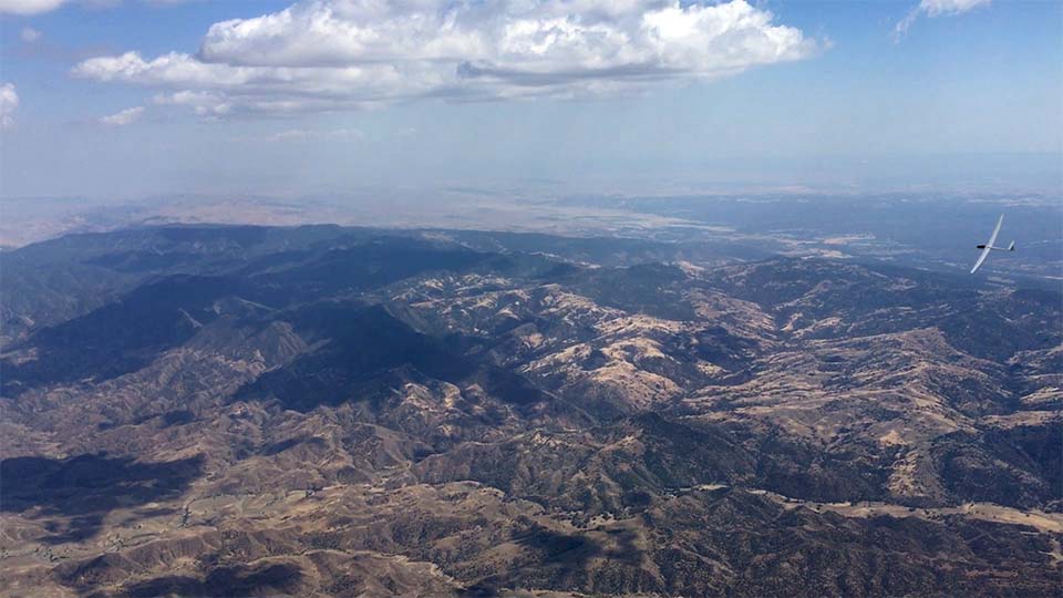
| Flying with a friend over the valley |
Eric was very helpful and periodically asked, “Kilo-Pop, what’s your safety airport right now?” It was so fun, and also reassuring, to have the visual flying contact and chats with him. Dan always knew our status from the flight computer in the back seat and replied right away. Dan and I coached and cheered each other on at times as we took a few turns at the controls, and kept trying to read the conditions and offer suggestions and course corrections to each other, and sometimes with Eric. Which side of the cloud was the lift on? Should we aim for the darkest area? Let’s explore this cloud off course over here just for fun (that was me). We’re in lift, turn right! Good job, you got it! There was a lot of chatter from the other gliders at various points along the route, which was helpful and interesting. There was a strong sense of community and everyone helping each other make the task, read the conditions, and get home safely.
We easily made it to Black Mountain team flying with ER, which everyone had been talking about on the radio all day as the southernmost destination, at the southern tip of the mountain ridges. Lacking a further line of mountains to the south, the clouds and convergence appeared to stop and I know many pilots had difficulty going further. We turned around.
Eric in his ASW-27 disappeared (he later told me he took a final glide at over 100 knots) leaving us to enjoy a slower trip home flying best L/D plus a few experimental explorations under nearby
clouds (me again). There were plenty of things to keep us busy and interested in as well as worrying about getting home before the lift died.

Thermaling at one point with ER was interesting, as the eastern side of the turn was in 8 kt lift, the western side in 2 kt lift and we watched as ER alternately rose above us and fell below during the arc as we thermaled together. It was amazing to get a clear visual reference for what a few seconds in net 6 knot lift will do to your altitude. We were expecting to see ER outperform us in climb within a few rotations but usually he was just flying faster or a little tighter and pulled up behind us. This flight was my first time entering a gaggle (four gliders at this point) while at the controls and Dan gave me some good tips and coaching about how best to enter and exit, it was a thrill.

On our glide back we “practiced not thermaling” making a mostly-straight line for home, and our resultant glide ratio at one point when I was flying moderate dolphin technique, Dan told me, even with some unfruitful side trip diversions, was averaging 71:1. We had some stretches of flying straight ahead at 70-80 knots and still climbing, trying to prevent not getting sucked too close to the clouds. The clouds eventually disappeared as we flew north and we were so high we could see the Panoche Valley over several ridges from a long distance. With plenty of altitude, Dan suggested we make a run/final glide of 106 km to the north past Mercy Hot Springs and as far north as the Release Ranch (but east of that waypoint) and return to our release point from tow, and then complete a lazy rectangle to bleed off our altitude while approaching Panoche. Eerily, the air over the Panoche Valley was dead still, in contrast to earlier when it had propelled many gliders to make an early release. Our total flight was 4.5 hours and 271 km, per OLC, which doesn’t include a lot of meandering, circling and yo-yoing!
After landing we helped other pilots disassemble and stow their gliders in trailers, then we got the remaining team to help load KP into its trailer. It had been hours since the last landing, most had left the field, and the sky had long since gone cold and the clouds vanished. Yet suddenly I was aware of a glider silently rolling up to a stop nearby. It was Ramy, another very long flight. I marvel how he stays up so long.

Huge thanks to Dan for sharing some stick time with me during his flight. He went to great lengths to plan the event and encourage pilots to attend, including drive sharing and helping everyone, loading KP into the trailer at Byron and assembling at Panoche and one more time loading into the trailer at Panoche, and offering to share his flights with NCSA, me and Ace. The team flying with Dan in the cockpit, and ER in the air, was a fabulous, fun learning experience. I was all grins, as was Dan.
It was a wonderful introduction to cross country flying, and hanging out with other pilots who were routinely flying far and hearing stories, humor, and chat over the radio during the flight, brought it all into focus. Particular thanks to Dan, Marianne, Eric and Ramy. I feel very fortunate to have experienced this, it’s truly unlike any other soaring. Thanks to NCSA for allowing us to take KP cross country. I’m officially hooked and can’t wait to go again.
-Todd
Subscribe to:
Posts (Atom)